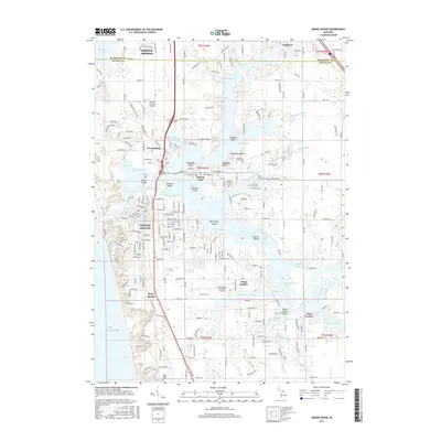
2017 Map of Grand Haven
USGS Topo · Published 2017About this map
Lake Michigan dominates the western edge of this 2017 survey, meeting a complex riverine landscape where the Grand River feeds into the lake. The city of Grand Haven occupies the southern bank, characterized by a dense street grid that includes Washington Ave and Columbus Ave, while Ferrysburg and Spring Lake sit across the water to the north. This area is defined by its numerous bayous and islands, such as Harbor Island, Dornbos Island, and Martinique Island, which illustrate the shifting nature of the local hydrology and the extensive shoreline development of the early 21st century.
Find a feature on this map
127 named features on this map. Tap any name to fly to it.
Don’t see what you’re looking for? This feature index may not catch every label — zoom into the map to look around manually.
Map Details
Editions of this 2017 Grand Haven Map
This is the sole edition of this map. No revisions or reprints were ever made.
Other maps of this area

1929 · Holland
USGS Topo · 1:62,500

1930 · Lake Harbor
USGS Topo · 1:48,000

1930 · Muskegon
USGS Topo · 1:62,500

1932 · Holland
USGS Topo · 1:62,500

1936 · Muskegon
USGS Topo · 1:62,500

1936 · Lake Harbor
USGS Topo · 1:62,500

1954 · Milwaukee
USGS Topo · 1:250,000

1958 · Milwaukee
USGS Topo · 1:250,000

1958 · Racine
USGS Topo · 1:250,000

1962 · Racine
USGS Topo · 1:250,000