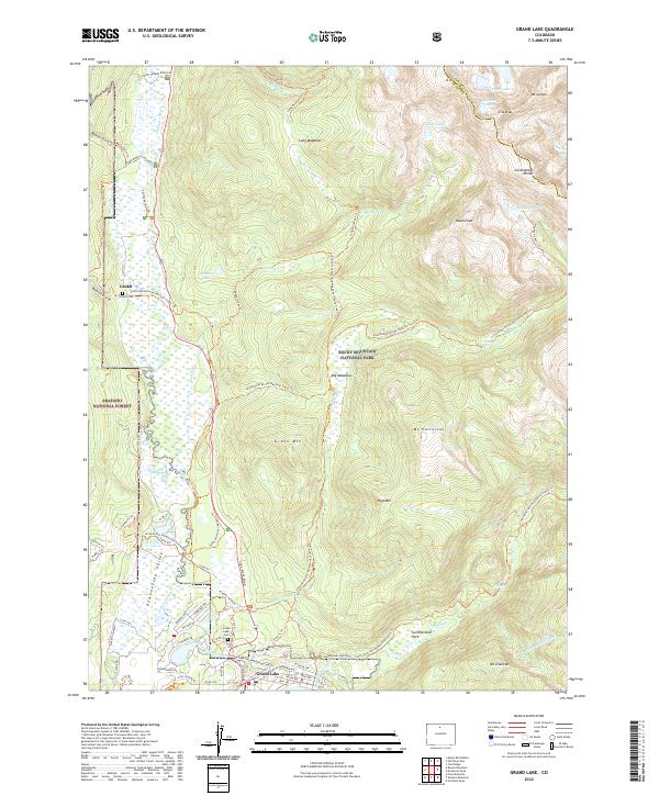
2022 Map of Grand Lake
USGS Topo · Published 2022About this map
Kawuneeche Valley serves as a primary corridor for the Colorado River as it winds south toward the town of Grand Lake. The 2022 landscape is defined by the meeting of Arapaho National Forest and Rocky Mountain National Park, where high-altitude landmarks like Mt Julian and Nakai Peak tower over a network of alpine lakes and meadows. Local history is anchored by the settlement of Gaskil and the adjacent Gaskill Cem, while the modern town of Grand Lake occupies the lower corner of the sheet. Significant engineering and recreation features are documented throughout, from the Alva B Adams Tunnel to the winding Trail Ridge Road and the extensive Continental Divide National Scenic Trl, illustrating the region's long-standing role as a gateway to the high Rockies.
Find a feature on this map
83 named features on this map. Tap any name to fly to it.
Don’t see what you’re looking for? This feature index may not catch every label — zoom into the map to look around manually.
Map Details
Editions of this 2022 Grand Lake Map
This is the sole edition of this map. No revisions or reprints were ever made.
Other maps of this area

1915 · Longs Peak
USGS Topo · 1:125,000

1919 · Rocky Mountain National Park
USGS Topo · 1:125,000

1954 · Greeley
USGS Topo · 1:250,000

1957 · Greeley
USGS Topo · 1:250,000

1957 · Mc Henrys Peak
USGS Topo · 1:24,000

1957 · Trail Ridge
USGS Topo · 1:24,000

1957 · Mount Richthofen
USGS Topo · 1:24,000

1957 · Bowen Mountain
USGS Topo · 1:24,000
1957 · Trail Mountain
USGS Topo · 1:24,000

1958 · Greeley
USGS Topo · 1:250,000