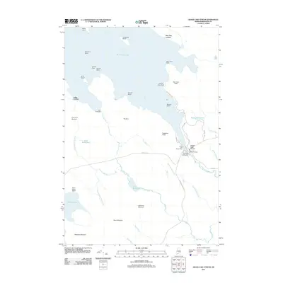
2011 Map of Grand Lake Stream
USGS Topo · Published 2011About this map
Grand Lake Stream serves as the focal point of this Washington County landscape, where the waters of West Grand Lake are managed by the Grand Lake Stream Dam. This area is defined by its deep connection to Maine's inland fisheries and timber history, anchored by the Grand Lake Stream State Fish Hatchery and the local Grand Lake Stream Post Office. The map captures a transition from the large lake environment, dotted with landmarks like Hardwood Island and Munson Island, to the complex drainage systems of the Little River and Rolfe Brook. To the west, the elevation rises toward Farm Cove Mountain and Wabassus Mountain, overlooking the smaller Wabassus Lake. The presence of sites such as Bear Trap Landing and Indian Landing indicates a longstanding tradition of water-based access and recreational usage along the rugged shorelines of Dyer Cove Ridge and Dawn Marie Beach.
Find a feature on this map
51 named features on this map. Tap any name to fly to it.
Don’t see what you’re looking for? This feature index may not catch every label — zoom into the map to look around manually.
Map Details
Editions of this 2011 Grand Lake Stream Map
This is the sole edition of this map. No revisions or reprints were ever made.
Other maps of this area

1940 · Waite
USGS Topo · 1:62,500

1941 · Scraggly Lake
USGS Topo · 1:62,500

1941 · Big Lake
USGS Topo · 1:62,500

1941 · Wabassus Lake
USGS Topo · 1:62,500

1942 · Waite
USGS Topo · 1:62,500

1943 · Big Lake
USGS Topo · 1:62,500

1943 · Wabassus Lake
USGS Topo · 1:62,500

1944 · Scraggly Lake
USGS Topo · 1:62,500

1952 · Big Lake
USGS Topo · 1:50,000

1953 · Wabassus Lake
USGS Topo · 1:62,500