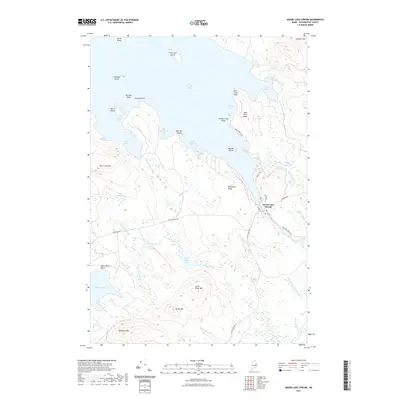
2021 Map of Grand Lake Stream
USGS Topo · Published 2021About this map
West Grand Lake dominates this portion of Washington County, its intricate shoreline defining the character of the settlement at Grand Lake Stream. Located at the lake's outlet, the village is the primary hub of activity, with streets like Water St and Canal St following the natural flow of the water toward Big Falls and Little Falls. The landscape is characterized by prominent elevations such as Farm Cove Mtn and Wabassus Mtn, which overlook a network of waterways including Grand Lake Brook and Rolfe Brook. Numerous islands, from the centrally located Munson Island to the remote Hardwood Island, dot the lake surface. This modern survey illustrates how local infrastructure, including Bonney Brook Rd and Wabassus Rd, provides access through the heavily wooded ridges and along the various coves.
Find a feature on this map
56 named features on this map. Tap any name to fly to it.
Don’t see what you’re looking for? This feature index may not catch every label — zoom into the map to look around manually.
Map Details
Editions of this 2021 Grand Lake Stream Map
This is the sole edition of this map. No revisions or reprints were ever made.
Other maps of this area

1940 · Waite
USGS Topo · 1:62,500

1941 · Scraggly Lake
USGS Topo · 1:62,500

1941 · Big Lake
USGS Topo · 1:62,500

1941 · Wabassus Lake
USGS Topo · 1:62,500

1942 · Waite
USGS Topo · 1:62,500

1943 · Big Lake
USGS Topo · 1:62,500

1943 · Wabassus Lake
USGS Topo · 1:62,500

1944 · Scraggly Lake
USGS Topo · 1:62,500

1952 · Big Lake
USGS Topo · 1:50,000

1953 · Wabassus Lake
USGS Topo · 1:62,500