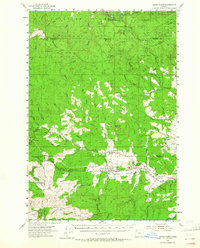
1955 Map of Grand Ronde
USGS Topo · Published 1965About this map
Grand Ronde Agency and the nearby community of Grand Ronde serve as the focal points of this mid-century survey of the Oregon Coast Range foothills. This area, where the Siuslaw National Forest meets the agricultural valleys of Yamhill and Polk counties, exhibits a landscape transitioning from timbered peaks like Mount Hebo and Saddleback Mountain to the river-bottom lands along the Salmon River. The infrastructure of the era is evident in the Portland And Salmon River Highway and the network of forest camps, including Camp Cooper and the Rocky Bend Forest Camp. Local heritage is preserved in landmarks such as the St Michael Sch, the Church in the Wildwood, and several rural school sites like Coneridge Sch. Geologists and researchers can also identify active industrial sites through various labeled quarries and the Radio Relay Sta atop the higher ridges.
Find a feature on this map
78 named features on this map. Tap any name to fly to it.
Don’t see what you’re looking for? This feature index may not catch every label — zoom into the map to look around manually.
Map Details
Editions of this 1955 Grand Ronde Map
2 editions found

Other maps of this area

1941 · Nestucca Bay
USGS Topo · 1:62,500

1942 · Ginger Peak
USGS Topo · 1:62,500

1942 · Euchre Mtn
USGS Topo · 1:62,500

1942 · Sheridan
USGS Topo · 1:62,500

1942 · Spirit Mtn
USGS Topo · 1:62,500

1942 · Nestucca Bay
USGS Topo · 1:62,500

1942 · Fairdale
USGS Topo · 1:62,500

1942 · Valsetz
USGS Topo · 1:62,500

1942 · Dallas
USGS Topo · 1:62,500

1942 · Tillamook
USGS Topo · 1:62,500