1959 Map of Grand Saline
USGS Topo · Published 1979About this map
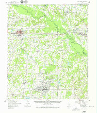
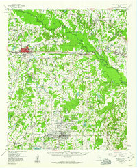
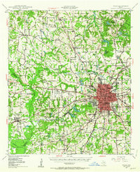
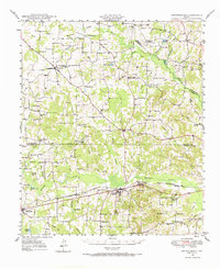
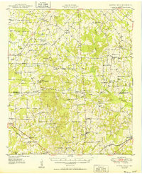
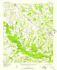
The Sabine River defines the landscape of this 1950s survey, winding through a region where petroleum and salt industries have reshaped the terrain. The presence of the Van Oil Field and the Nolan-Edwards Oil Field indicates the intense energy production of the era, while the Salt Ponds and a Disposal Well near Grand Saline highlight the local mineral economy. This transition from agricultural roots to industrial resource extraction is further evidenced by the Texas and Pacific railroad line, which provides a primary transportation corridor between the regional hubs.
Find a feature on this map
96 named features on this map. Tap any name to fly to it.
Don’t see what you’re looking for? This feature index may not catch every label — zoom into the map to look around manually.
Map Details
Editions of this 1959 Grand Saline Map
2 editions found
Other maps of this area
1948 · Tyler
USGS Topo · 1:62,500
1948 · Brownsboro
USGS Topo · 1:62,500
1948 · Martins Mill
USGS Topo · 1:62,500
1949 · Tyler
USGS Topo · 1:62,500
1949 · Martins Mill
USGS Topo · 1:62,500
1949 · Brownsboro
USGS Topo · 1:62,500

1956 · Tyler
USGS Topo · 1:250,000
1956 · Emory
USGS Topo · 1:62,500
1958 · Alba
USGS Topo · 1:24,000
1959 · Calvary
USGS Topo · 1:24,000