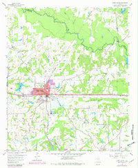
1959 Map of Grand Saline
USGS Topo · Published 1982About this map
The industrial and agricultural landscape of eastern Van Zandt County is anchored by Grand Saline, where the Texas and Pacific railroad corridor and the nearby Morton Mine define the local economy. This 1959 survey (with 1980s updates) illustrates a terrain shaped by both industry and the meandering Sabine River to the north. Rural life is well-documented through a network of small landmarks such as Friendship Sch, Crossroads Ch, and several family cemeteries including Rodgers Cem and Padgett Cem. The map reveals the area’s water management and transport history, from the Artesian Well and City Lake near the town center to the old crossing at Collins Ferry on the river. The presence of the Old Railroad Grade north of town provides a clear path for tracing former transport routes through the creek-fed lowlands of Caney Creek and Grand Saline Creek.
Find a feature on this map
35 named features on this map. Tap any name to fly to it.
Don’t see what you’re looking for? This feature index may not catch every label — zoom into the map to look around manually.
Map Details
Editions of this 1959 Grand Saline Map
Other maps of this area

1956 · Tyler
USGS Topo · 1:250,000

1956 · Emory
USGS Topo · 1:62,500

1958 · Alba
USGS Topo · 1:24,000

1959 · Calvary
USGS Topo · 1:24,000

1959 · Golden
USGS Topo · 1:24,000

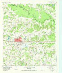
1959 · Grand Saline
USGS Topo · 1:24,000

1959 · Van
USGS Topo · 1:24,000

1959 · Van Lake
USGS Topo · 1:24,000

1959 · Grand Saline
USGS Topo · 1:62,500

1959 · Alba
USGS Topo · 1:62,500