
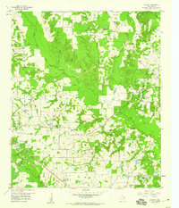
1959 Map of Calvary
USGS Topo · Published 1960About this map
The Wood County countryside near Alba was defined by resource extraction and rural faith during the late 1950s. The landscape is a network of small creeks and oil operations, with the Alba Oil Field and the Quitman Oil Field visible alongside an Old Railroad Grade that speaks to the area's earlier transport patterns. Family and community history is anchored by numerous rural congregations, including Enon Ch, Pleasant Ridge Ch, and Pilgrims Rest No 2 Ch.
Find a feature on this map
39 named features on this map. Tap any name to fly to it.
Don’t see what you’re looking for? This feature index may not catch every label — zoom into the map to look around manually.
Map Details
Editions of this 1959 Calvary Map
4 editions found
Other maps of this area

1956 · Tyler
USGS Topo · 1:250,000

1958 · Arbala
USGS Topo · 1:24,000

1958 · Alba
USGS Topo · 1:24,000

1959 · Golden
USGS Topo · 1:24,000

1959 · Grand Saline
USGS Topo · 1:24,000

1959 · Yantis
USGS Topo · 1:24,000

1959 · Grand Saline
USGS Topo · 1:62,500

1959 · Alba
USGS Topo · 1:62,500

1960 · Mineola
USGS Topo · 1:24,000

1960 · Pleasant Grove
USGS Topo · 1:24,000