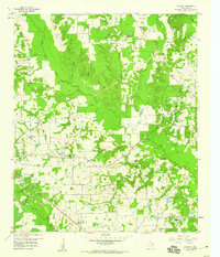
1959 Map of Calvary
USGS Topo · Published 1960About this map
The Alba Oil Field and Quitman Oil Field dominate the industrial landscape of this Wood County region at the end of the 1950s. While oil production was a primary economic driver, the presence of an Old Railroad Grade running southwest from Alba toward the edge of the sheet points to an earlier era of transport and resource extraction. The map identifies several small Old Mining Areas and numerous Gravel Pits scattered near the winding path of Lake Fork Creek, suggesting a diverse history of land use before the modern petroleum focus.
Find a feature on this map
45 named features on this map. Tap any name to fly to it.
Don’t see what you’re looking for? This feature index may not catch every label — zoom into the map to look around manually.
Map Details
Editions of this 1959 Calvary Map
4 editions found
Other maps of this area

1956 · Tyler
USGS Topo · 1:250,000

1958 · Arbala
USGS Topo · 1:24,000

1958 · Alba
USGS Topo · 1:24,000

1959 · Calvary
USGS Topo · 1:24,000

1959 · Golden
USGS Topo · 1:24,000

1959 · Grand Saline
USGS Topo · 1:24,000

1959 · Yantis
USGS Topo · 1:24,000

1959 · Grand Saline
USGS Topo · 1:62,500

1959 · Alba
USGS Topo · 1:62,500

1960 · Mineola
USGS Topo · 1:24,000