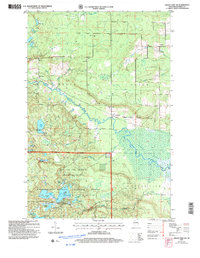
2005 Map of Grand View NW
USGS Topo · Published 2006About this map
The Chequamegon-Nicolet National Forest dominates this northern Wisconsin landscape, revealing a densely wooded terrain punctuated by glacial lakes and wetlands. The intricate hydraulics of the White River and the expansive White River Marsh define the southern and central portions of the sheet, where the Star Lake Semi-Primitive Non-Motorized Area preserves a backcountry character.
Find a feature on this map
37 named features on this map. Tap any name to fly to it.
Don’t see what you’re looking for? This feature index may not catch every label — zoom into the map to look around manually.
Map Details
Editions of this 2005 Grand View NW Map
This is the sole edition of this map. No revisions or reprints were ever made.
Other maps of this area

1943 · Iron Lake
USGS Topo · 1:48,000

1944 · Moquah
USGS Topo · 1:48,000

1944 · Drummond
USGS Topo · 1:48,000

1944 · Grandview
USGS Topo · 1:48,000

1947 · Drummond
USGS Topo · 1:48,000

1947 · Moquah
USGS Topo · 1:48,000

1947 · Iron Lake
USGS Topo · 1:48,000

1947 · Grandview
USGS Topo · 1:48,000

1953 · Ashland
USGS Topo · 1:250,000

1958 · Ashland
USGS Topo · 1:250,000