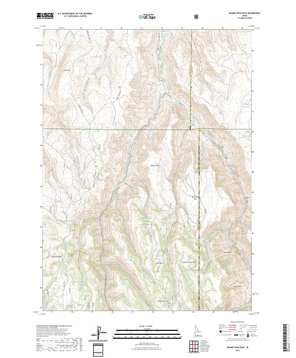
2023 Map of Grand View Peak
USGS Topo · Published 2023About this map
Grand View Peak stands as the high point of this high-elevation landscape within the Sawtooth National Forest, straddling the border of Twin Falls and Cassia counties. The terrain is defined by a dense network of gulches and creeks, including Fifth Fork Rock Creek and Jones Fork Creek, which carve through plateaus like Sagehen Flats and Buckbrush Flats. The distribution of water sources is critical in this environment, marked by numerous named springs such as Cherry Spring, Pole Camp Spring, and Sugarloaf Spring. Evidence of high-country land use is visible in the transition between open basins like Donahue Basin and Steer Basin and the rugged buttes, including Wooden Shoe Butte. The presence of the Lincoln Reservoir and trails like the Electric Mud Spr Trl suggest a landscape balanced between resource management and recreation.
Find a feature on this map
49 named features on this map. Tap any name to fly to it.
Don’t see what you’re looking for? This feature index may not catch every label — zoom into the map to look around manually.
Map Details
Editions of this 2023 Grand View Peak Map
This is the sole edition of this map. No revisions or reprints were ever made.
Other maps of this area

1955 · Twin Falls
USGS Topo · 1:250,000

1958 · Twin Falls
USGS Topo · 1:250,000

1965 · Rams Horn Ridge
USGS Topo · 1:24,000

1965 · Stricker Butte
USGS Topo · 1:24,000

1965 · Grand View Peak
USGS Topo · 1:24,000

1965 · Hub Butte
USGS Topo · 1:24,000

1965 · Murtaugh
USGS Topo · 1:24,000

1965 · Mc Mullen Basin
USGS Topo · 1:24,000

1978 · Hopper Gulch
USGS Topo · 1:24,000
1978 · Pike Mountain
USGS Topo · 1:24,000