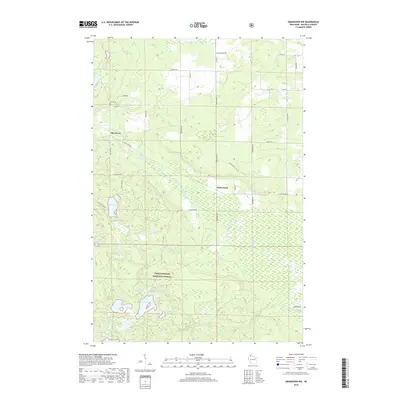
2018 Map of Grandview NW
USGS Topo · Published 2018About this map
Chequamegon National Forest encompasses the southern half of this landscape, where a dense network of glacial water bodies like Star Lake, Nymphia Lake, and Anodonta Lake dot the wooded terrain. The northern portion transitions into more open topography around the small settlement of Sutherland, positioned near the expansive Bibon Marsh. Evidence of early 20th-century community development remains visible at the Delta Cem and along local transport routes such as Mason-Snake Trail Rd and Pike River Rd. The area is defined by its complex hydrology, with White River and its numerous tributaries, including Hanson Cr and Johnson Cr, carving through the timberland. This detailed survey preserves the specific layout of forest roads and rural family-named routes like Visocky Rd and Knabe Rd as they existed in the late 2010s.
Find a feature on this map
50 named features on this map. Tap any name to fly to it.
Don’t see what you’re looking for? This feature index may not catch every label — zoom into the map to look around manually.
Map Details
Editions of this 2018 Grandview NW Map
This is the sole edition of this map. No revisions or reprints were ever made.
Other maps of this area

1943 · Iron Lake
USGS Topo · 1:48,000

1944 · Moquah
USGS Topo · 1:48,000

1944 · Drummond
USGS Topo · 1:48,000

1944 · Grandview
USGS Topo · 1:48,000

1947 · Drummond
USGS Topo · 1:48,000

1947 · Moquah
USGS Topo · 1:48,000

1947 · Iron Lake
USGS Topo · 1:48,000

1947 · Grandview
USGS Topo · 1:48,000

1953 · Ashland
USGS Topo · 1:250,000

1958 · Ashland
USGS Topo · 1:250,000