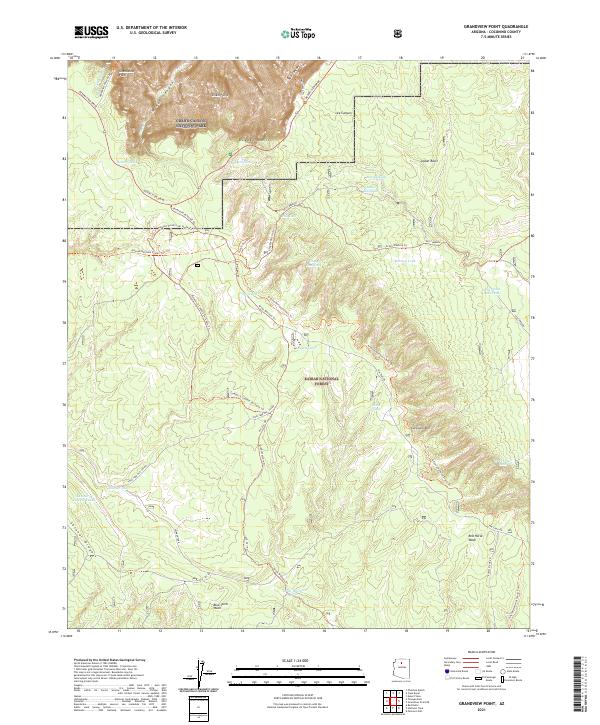
2021 Map of Grandview Point
USGS Topo · Published 2021About this map
Grandview Point and the striking Sinking Ship formation dominate the northern reaches of this landscape, where the high desert plateau gives way to the depths of Grand Canyon National Park. The terrain is defined by the sharp drop-off at the Coconino Rim, a transition point between the densely forested Kaibab National Forest and the dramatic canyon geology below. Historical movement through this area is traced by a network of primitive routes and trails, including the Arizona National Scenic Trl and the Old Cameron road, which historically linked these remote overlooks to wider transit networks.
Find a feature on this map
47 named features on this map. Tap any name to fly to it.
Don’t see what you’re looking for? This feature index may not catch every label — zoom into the map to look around manually.
Map Details
Editions of this 2021 Grandview Point Map
This is the sole edition of this map. No revisions or reprints were ever made.
Other maps of this area

1886 · San Francisco Mtns
USGS Topo · 1:250,000

1886 · Chino
USGS Topo · 1:250,000

1886 · Echo Cliffs
USGS Topo · 1:250,000

1886 · Kaibab
USGS Topo · 1:250,000

1891 · San Francisco Mtns
USGS Topo · 1:250,000

1891 · Chino
USGS Topo · 1:250,000

1891 · Echo Cliffs
USGS Topo · 1:250,000

1894 · San Francisco Mtns
USGS Topo · 1:250,000

1899 · San Francisco Mtns
USGS Topo · 1:250,000

1903 · Bright Angel
USGS Topo · 1:48,000