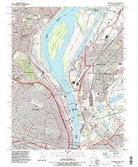
2024 Map of Granite City
USGS Topo · Published 2024About this map
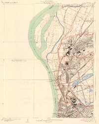
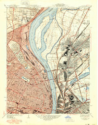
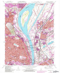
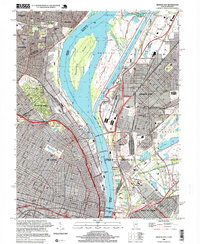
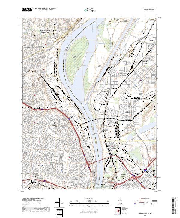
The Mississippi River serves as the primary artery of this urban and industrial landscape, dividing the metropolitan centers of St. Louis and East St. Louis. On the Missouri side, the riverfront is defined by the iconic Gateway Arch National Park and dense academic clusters including the Saint Louis University Main Campus and Ranken Technical College. The terrain north of the city center transitions into a vast corridor of memorial sites, notably the expansive Calvary Cem and Mausoleum and Bellefontaine Cem. Across the water, the Illinois floodplain known as the American Bottoms contains the industrial and residential hubs of Granite City, Madison, and Venice. The river's complexity is revealed through features like the Chain of Rocks Canal and Mosenthein Island, illustrating the massive engineering efforts required to manage navigation and flood control for these interconnected river cities.
Find a feature on this map
61 named features on this map. Tap any name to fly to it.
Don’t see what you’re looking for? This feature index may not catch every label — zoom into the map to look around manually.
Map Details
Editions of this 2024 Granite City Map
This is the sole edition of this map. No revisions or reprints were ever made.
Historical Maps of Madison Through Time
7 maps found