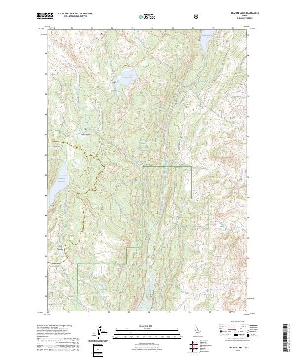
2024 Map of Granite Lake
USGS Topo · Published 2024About this map
The North Fork Payette River corridor serves as the primary north-south artery through this portion of the Payette National Forest. This modern cartographic study documents a landscape defined by high-elevation water storage and forest management, where Warren Wagon Rd parallels the river, providing access to the southern shore of Upper Payette Lake. High meadows such as Sater Meadows and Hartly Meadows provide topographic breaks in the timbered terrain, while the Deep Creek Trl offers a pedestrian route into the backcountry surrounding Granite Lake. The boundary between Valley and Adams counties cuts through the western edge of the quadrangle, crossing the drainage of Fisher Creek and the localized catchment for Brundage Reservoir.
Find a feature on this map
33 named features on this map. Tap any name to fly to it.
Don’t see what you’re looking for? This feature index may not catch every label — zoom into the map to look around manually.
Map Details
Editions of this 2024 Granite Lake Map
This is the sole edition of this map. No revisions or reprints were ever made.
Other maps of this area

1911 · Meadows
USGS Topo · 1:125,000

1938 · Riggins
USGS Topo · 1:96,000

1945 · Riggins
USGS Topo · 1:125,000

1955 · Baker
USGS Topo · 1:250,000

1955 · Grangeville
USGS Topo · 1:250,000

1956 · Elk City
USGS Topo · 1:250,000

1957 · Challis
USGS Topo · 1:250,000

1959 · Baker
USGS Topo · 1:250,000

1959 · Grangeville
USGS Topo · 1:250,000

1960 · Elk City
USGS Topo · 1:250,000