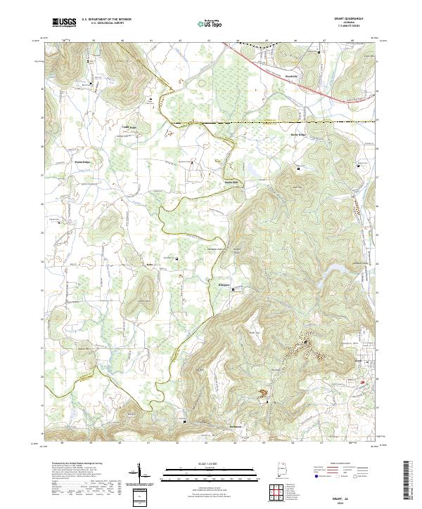
2024 Map of Grant
USGS Topo · Published 2024About this map
The Paint Rock River winds through this northern Alabama landscape, marking a topographically complex region where the borders of Jackson, Madison, and Marshall counties converge. The terrain is defined by prominent elevations such as Keel Mtn and Gunters Mtn, separated by deep hollows like Greasy Hollow and Fletcher Hollow. Settlement patterns here follow the lower elevations and river valleys, with established communities at Woodville and Grant serving as local anchors. Numerous family-named landmarks and cemeteries, including Whittaker Cem near Nebo and Perkins Cem in the east, provide significant data points for genealogical research. The presence of features like Butler Mill and The Sinks suggests a history tied to both early industry and the unique karst geology of the plateau edges.
Find a feature on this map
126 named features on this map. Tap any name to fly to it.
Don’t see what you’re looking for? This feature index may not catch every label — zoom into the map to look around manually.
Map Details
Editions of this 2024 Grant Map
This is the sole edition of this map. No revisions or reprints were ever made.
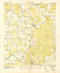
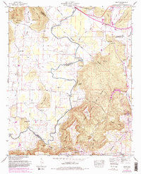
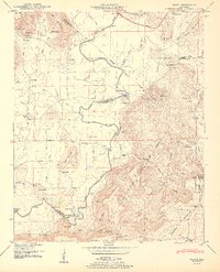
Historical Maps of Nebo Through Time
4 maps found