2023 Map of Grantsville
USGS Topo · Published 2023About this map
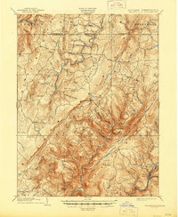
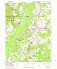
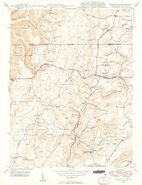
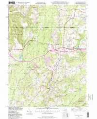
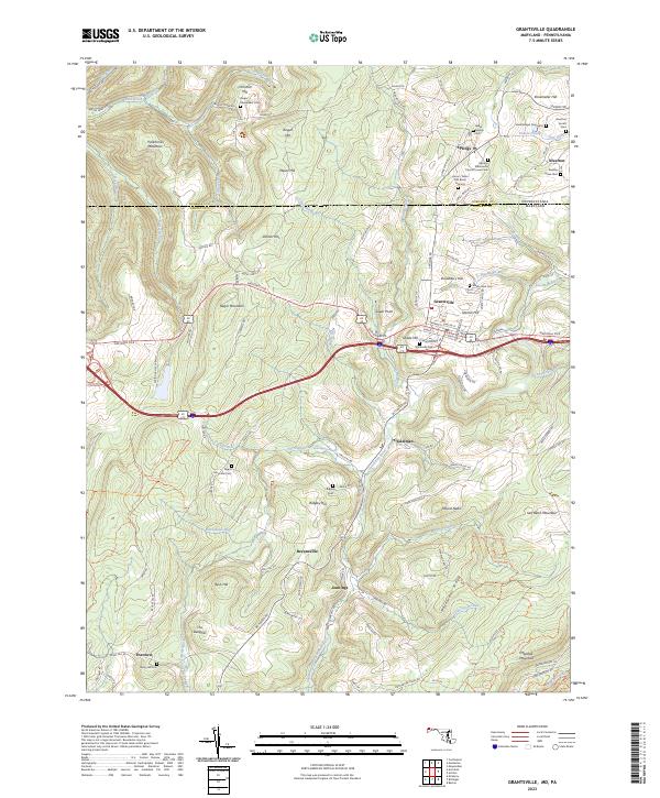
Negro Mountain rises as a dominant geographic feature in this corner of Garrett County, where the historic National Pike traverses the high ground before descending toward the Casselman River. The landscape is a patchwork of small communities and family legacies, notably around the town of Grantsville and the cross-border settlements of Springs and Niverton. Genealogy is etched into the terrain through numerous small burial sites, including the Amos J Yoder Old Burial Ground, the Hershberger Graveyard, and the Niverton Amish Cem. The Casselman River and its many tributaries, such as Shade Run and Schoolhouse Run, have historically shaped the settlement patterns here, providing a water-rich environment for the farms and homes that line roads like Bittinger Rd and New Germany Rd. From Mount Nebo to Salt Block Mountain, the map documents a resilient rural character defined by long-standing church congregations like the Springs Mennonite Church.
Find a feature on this map
79 named features on this map. Tap any name to fly to it.
Don’t see what you’re looking for? This feature index may not catch every label — zoom into the map to look around manually.
Map Details
Editions of this 2023 Grantsville Map
This is the sole edition of this map. No revisions or reprints were ever made.
Historical Maps of Foxtown Through Time
7 maps found