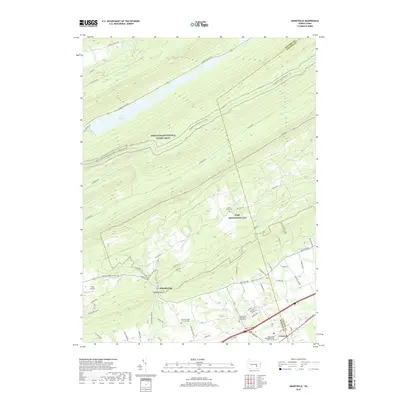
2019 Map of Grantville
USGS Topo · Published 2019About this map
Grantville and the southern edge of Fort Indiantown Gap define the lower reaches of this 2019 survey, where the suburban development of East Hanover Township meets the sharp ridgelines of the Blue Mountains. The landscape is dominated by the northeast-southwest trending ridges that shelter Stony Creek and Clarks Valley Road, creating a corridor for the Appalachian National Scenic Trail and the expansive DeHart Reservoir. Historical traces of previous transport and industry remain visible, such as the Old RR Bed running parallel to Stony Creek and the notable Devils Race Course boulder field.
Find a feature on this map
68 named features on this map. Tap any name to fly to it.
Don’t see what you’re looking for? This feature index may not catch every label — zoom into the map to look around manually.
Map Details
Editions of this 2019 Grantville Map
This is the sole edition of this map. No revisions or reprints were ever made.
Other maps of this area

1892 · Lykens
USGS Topo · 1:62,500

1892 · Hummelstown
USGS Topo · 1:62,500

1892 · Harrisburg
USGS Topo · 1:62,500

1893 · Lykens
USGS Topo · 1:62,500

1893 · Millersburg
USGS Topo · 1:62,500

1899 · Harrisburg
USGS Topo · 1:62,500

1924 · Hummelstown
USGS Topo · 1:62,500

1924 · Harrisburg
USGS Topo · 1:62,500

1943 · Millersburg
USGS Topo · 1:62,500

1943 · Lykens
USGS Topo · 1:62,500
Featured Places
- East Hanover Township, PA
- Cold Spring Township, PA
- East Hanover Township, PA
- Manada Gap, East Hanover Township
- Grantville, East Hanover Township