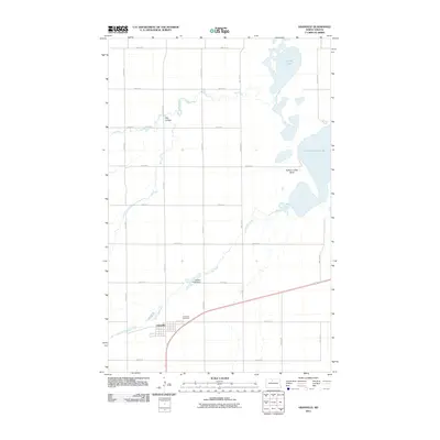
2011 Map of Granville
USGS Topo · Published 2011About this map
Granville anchors this McHenry County landscape, showing its organized town grid south of the Granville Cemetery. The surrounding terrain is defined by the winding course of Egg Creek and South Egg Creek, which drain a region of glacial lakes and coulees. To the northeast, the significant waters of Buffalo Lodge Lake and the smaller North Lake dominate the geography, while the prominence of Buffalo Lodge Butte rises above the eastern plains.
Find a feature on this map
25 named features on this map. Tap any name to fly to it.
Don’t see what you’re looking for? This feature index may not catch every label — zoom into the map to look around manually.
Map Details
Editions of this 2011 Granville Map
This is the sole edition of this map. No revisions or reprints were ever made.
Other maps of this area

1948 · Velva
USGS Topo · 1:62,500

1949 · Norwich
USGS Topo · 1:24,000

1949 · Granville NE
USGS Topo · 1:24,000

1949 · Simcoe
USGS Topo · 1:24,000

1949 · Granville NW
USGS Topo · 1:24,000

1949 · Riga
USGS Topo · 1:24,000

1949 · Granville SW
USGS Topo · 1:24,000

1949 · Karlsruhe NW
USGS Topo · 1:24,000

1949 · Granville
USGS Topo · 1:24,000

1950 · Bantry NW
USGS Topo · 1:24,000