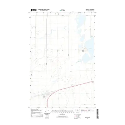
2014 Map of Granville
USGS Topo · Published 2014About this map
The settlement of Granville sits at the intersection of Us-2 and a grid of local section roads, serving as a hub for the surrounding agricultural prairie. To the north, the landscape is defined by a series of wetlands and water bodies, most notably the expansive Buffalo Lodge Lake and the smaller North Lake. These waters are fed and connected by the winding paths of Egg Creek and South Egg Creek, which traverse the terrain alongside natural drainage features like Hay Coulee.
Find a feature on this map
29 named features on this map. Tap any name to fly to it.
Don’t see what you’re looking for? This feature index may not catch every label — zoom into the map to look around manually.
Map Details
Editions of this 2014 Granville Map
This is the sole edition of this map. No revisions or reprints were ever made.
Other maps of this area

1948 · Velva
USGS Topo · 1:62,500

1949 · Norwich
USGS Topo · 1:24,000

1949 · Granville NE
USGS Topo · 1:24,000

1949 · Simcoe
USGS Topo · 1:24,000

1949 · Granville NW
USGS Topo · 1:24,000

1949 · Riga
USGS Topo · 1:24,000

1949 · Granville SW
USGS Topo · 1:24,000

1949 · Karlsruhe NW
USGS Topo · 1:24,000

1949 · Granville
USGS Topo · 1:24,000

1950 · Bantry NW
USGS Topo · 1:24,000