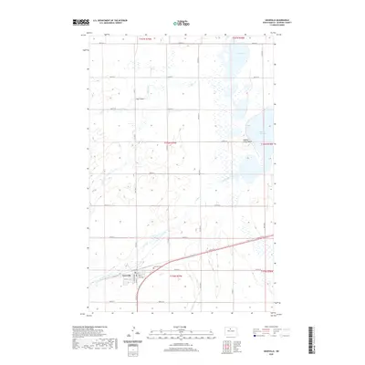
2020 Map of Granville
USGS Topo · Published 2020About this map
Granville serves as the primary hub in this agricultural landscape of McHenry County, where the grid of sections meets the meandering course of Egg Creek. The town is organized around a traditional street plan featuring Garfield Ave, Main St S, and numbered streets that reflect its history as a prairie rail settlement. To the east, the terrain rises toward Buffalo Lodge Butte, overlooking the expansive waters of Buffalo Lodge Lake and North Lake. This area is characterized by its complex hydrology, with numerous smaller wetlands and coulees like Hay Coulee punctuating the plains. The presence of the Granville Cem south of the main township provides a specific point of interest for genealogists tracing early families of the region. The map reveals the relationship between the natural drainage of South Egg Creek and the strictly surveyed township and range lines that have defined North Dakota land use for over a century.
Find a feature on this map
38 named features on this map. Tap any name to fly to it.
Don’t see what you’re looking for? This feature index may not catch every label — zoom into the map to look around manually.
Map Details
Editions of this 2020 Granville Map
This is the sole edition of this map. No revisions or reprints were ever made.
Other maps of this area

1948 · Velva
USGS Topo · 1:62,500

1949 · Norwich
USGS Topo · 1:24,000

1949 · Granville NE
USGS Topo · 1:24,000

1949 · Simcoe
USGS Topo · 1:24,000

1949 · Granville NW
USGS Topo · 1:24,000

1949 · Riga
USGS Topo · 1:24,000

1949 · Granville SW
USGS Topo · 1:24,000

1949 · Karlsruhe NW
USGS Topo · 1:24,000

1949 · Granville
USGS Topo · 1:24,000

1950 · Bantry NW
USGS Topo · 1:24,000