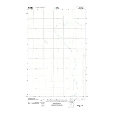
2011 Map of Granville NE
USGS Topo · Published 2011About this map
Cut Bank Creek winds through this rural section of McHenry County, its meandering course providing the primary natural break in a landscape defined by an orderly grid of section-line roads. This survey of the Granville NE area reveals a region dedicated almost exclusively to large-scale agriculture, where the intersection of north-south avenues and east-west streets creates uniform blocks for farming. In the southern reach of the quadrangle, North Lake appears as a notable water body against the otherwise dry prairie terrain. The infrastructure is characterized by a high-density network of local thoroughfares, including 10th Ave N and 70th St N, which facilitate movement between farmsteads and transport hubs. This map provides a clear picture of the modern Midwestern township structure, where the natural hydrology of the creek and lake systems must reconcile with a strictly engineered human geography.
Find a feature on this map
16 named features on this map. Tap any name to fly to it.
Don’t see what you’re looking for? This feature index may not catch every label — zoom into the map to look around manually.
Map Details
Editions of this 2011 Granville NE Map
This is the sole edition of this map. No revisions or reprints were ever made.
Other maps of this area

1948 · Newburg SW
USGS Topo · 1:24,000

1949 · Granville NE
USGS Topo · 1:24,000

1949 · Newburg SW
USGS Topo · 1:24,000

1949 · Granville NW
USGS Topo · 1:24,000

1949 · Riga
USGS Topo · 1:24,000

1949 · Granville SW
USGS Topo · 1:24,000

1949 · Granville
USGS Topo · 1:24,000

1950 · Upham
USGS Topo · 1:24,000

1950 · Newburg SE
USGS Topo · 1:24,000

1950 · Bantry NW
USGS Topo · 1:24,000