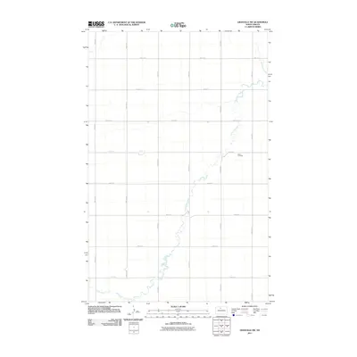
2011 Map of Granville NW
USGS Topo · Published 2011About this map
Little Deep Creek meanders through this portion of McHenry County, defining the drainage patterns across a landscape structured by a precise section-line road grid. The presence of Saline Cemetery near the intersection of 71st St N and 15th Ave N serves as a primary historical waypoint for the area, marking a site of local genealogical significance. The terrain is characterized by the contrast between the sinuous, natural path of the creek and the rigid agricultural boundaries established by thoroughfares such as 74th St N and 19th Ave N. This cartographic record from the U.S. Geological Survey details the rural infrastructure of North Dakota in the early twenty-first century, providing a clear view of the relationship between water resources and land division.
Find a feature on this map
16 named features on this map. Tap any name to fly to it.
Don’t see what you’re looking for? This feature index may not catch every label — zoom into the map to look around manually.
Map Details
Editions of this 2011 Granville NW Map
This is the sole edition of this map. No revisions or reprints were ever made.
Other maps of this area

1948 · Newburg SW
USGS Topo · 1:24,000

1949 · Granville NE
USGS Topo · 1:24,000

1949 · Newburg SW
USGS Topo · 1:24,000

1949 · Deering SE
USGS Topo · 1:24,000

1949 · Granville NW
USGS Topo · 1:24,000

1949 · Granville SW
USGS Topo · 1:24,000

1949 · Eckman SE
USGS Topo · 1:24,000

1949 · Deering
USGS Topo · 1:24,000

1949 · Granville
USGS Topo · 1:24,000
1950 · Deering
USGS Topo · 1:62,500