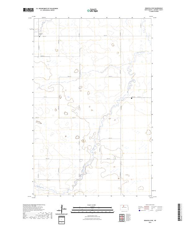
2024 Map of Granville NW
USGS Topo · Published 2024About this map
Little Deep Creek meanders across this rural expanse of McHenry County, defining the drainage patterns for the surrounding prairie. This agricultural landscape is organized by a strict grid of section lines and gravel roads, including 18th Ave N and 72nd St N, which reflect the enduring legacy of the Public Land Survey System. For genealogists and local historians, the presence of Saint Olaf Lutheran Cem in the northwest and Saline Cem to the east provides critical markers of early settlement and community life in this portion of North Dakota. The map illustrates how the watercourse of Little Deep Creek dictates the few variations in an otherwise uniform terrain of farmsteads and open fields.
Find a feature on this map
22 named features on this map. Tap any name to fly to it.
Don’t see what you’re looking for? This feature index may not catch every label — zoom into the map to look around manually.
Map Details
Editions of this 2024 Granville NW Map
This is the sole edition of this map. No revisions or reprints were ever made.
Other maps of this area

1948 · Newburg SW
USGS Topo · 1:24,000

1949 · Granville NE
USGS Topo · 1:24,000

1949 · Newburg SW
USGS Topo · 1:24,000

1949 · Deering SE
USGS Topo · 1:24,000

1949 · Granville NW
USGS Topo · 1:24,000

1949 · Granville SW
USGS Topo · 1:24,000

1949 · Eckman SE
USGS Topo · 1:24,000

1949 · Deering
USGS Topo · 1:24,000

1949 · Granville
USGS Topo · 1:24,000
1950 · Deering
USGS Topo · 1:62,500