
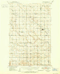
1949 Map of Granville NW
USGS Topo · Published 1949About this map
Little Deep Creek meanders through this portion of McHenry County, defining a landscape of agricultural sections and scattered rural institutions. Prepared for the Department of the Interior's Missouri River Basin development program, the survey highlights the social infrastructure of the late 1940s, including St. Olaf Ch and Saline Cem. The mapping reflects a period when localized education was still anchored by country schoolhouses like Barton Sch and School No 2. This terrain, characterized by features such as Spring Coulee, shows a highly organized grid of township lines that organized the North Dakota prairie into distinct zones like Grilley, Deering, and Saline.
Find a feature on this map
10 named features on this map. Tap any name to fly to it.
Don’t see what you’re looking for? This feature index may not catch every label — zoom into the map to look around manually.
Map Details
Editions of this 1949 Granville NW Map
This is the sole edition of this map. No revisions or reprints were ever made.
Other maps of this area

1948 · Newburg SW
USGS Topo · 1:24,000

1949 · Granville NE
USGS Topo · 1:24,000

1949 · Newburg SW
USGS Topo · 1:24,000

1949 · Deering SE
USGS Topo · 1:24,000

1949 · Granville SW
USGS Topo · 1:24,000

1949 · Eckman SE
USGS Topo · 1:24,000

1949 · Deering
USGS Topo · 1:24,000

1949 · Granville
USGS Topo · 1:24,000
1950 · Deering
USGS Topo · 1:62,500

1950 · Newburg SE
USGS Topo · 1:24,000