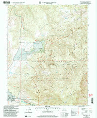
2002 Map of Grass Valley
USGS Topo · Published 2005About this map
Dixie National Forest dominates this mountain landscape, where the headwaters of the Santa Clara River converge near the high peaks of the Pine Valley Mountains. In the south, the settlement of Pine Valley serves as a hub for the Pine Valley Recreation Area, with specific campgrounds noted including Ponderosa, Lower Pines, and Upper Pines. The map records a transition from traditional land uses to conservation and recreation, showing working homesteads like Rencher Ranch and Gardner Ranch alongside protected wilderness boundaries.
Find a feature on this map
72 named features on this map. Tap any name to fly to it.
Don’t see what you’re looking for? This feature index may not catch every label — zoom into the map to look around manually.
Map Details
Editions of this 2002 Grass Valley Map
This is the sole edition of this map. No revisions or reprints were ever made.
Other maps of this area

1885 · St. George
USGS Topo · 1:250,000

1891 · St. George
USGS Topo · 1:250,000

1950 · Iron Mountain
USGS Topo · 1:62,500

1950 · Stoddard Mtn
USGS Topo · 1:24,000

1950 · Page Ranch
USGS Topo · 1:24,000

1951 · Stoddard Mtn
USGS Topo · 1:24,000

1951 · Page Ranch
USGS Topo · 1:24,000

1953 · Cedar City
USGS Topo · 1:250,000

1954 · La Verkin 2 SE
USGS Topo · 1:24,000

1957 · New Harmony
USGS Topo · 1:62,500