
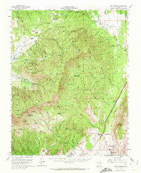
1957 Map of New Harmony
USGS Topo · Published 1960About this map
Dixie National Forest dominates this mid-century landscape where high timbered ridges meet the Hurricane Cliffs. The map illustrates a rural economy centered on established ranches and early water management systems, notably the Pintura Ditch and numerous upland reservoirs like White Rocks Reservoir and Jones Hollow Reservoir. These water sources supported remote outposts such as Rencher Ranch and Gardner Ranch, which are shown alongside several Forest Service landmarks including the Browse Area Guard Station.
Find a feature on this map
80 named features on this map. Tap any name to fly to it.
Don’t see what you’re looking for? This feature index may not catch every label — zoom into the map to look around manually.
Map Details
Editions of this 1957 New Harmony Map
2 editions found
Other maps of this area

1885 · St. George
USGS Topo · 1:250,000

1891 · St. George
USGS Topo · 1:250,000

1950 · Kanarraville
USGS Topo · 1:24,000

1950 · Iron Mountain
USGS Topo · 1:62,500

1950 · Cedar City
USGS Topo · 1:62,500

1950 · Stoddard Mtn
USGS Topo · 1:24,000

1950 · Page Ranch
USGS Topo · 1:24,000

1951 · Kanarraville
USGS Topo · 1:24,000

1951 · Stoddard Mtn
USGS Topo · 1:24,000

1951 · Page Ranch
USGS Topo · 1:24,000