
1950 Map of Kanarraville
USGS Topo · Published 1950About this map
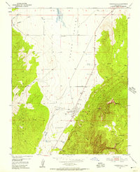
Kanarraville sits at the foot of the Hurricane Cliffs, serving as a gateway between the agricultural flatlands of Cedar Valley and the steep elevation of the North Hills. Surveyed in 1950, this landscape reveals the vital water management strategies of Southern Utah, where Quichapa Lake and numerous diversions like Quichapa Creek and Kanarra Creek supported the local settlement. The eastern edge of the map transitions into the federally protected lands of Zion National Monument, highlighting the proximity of the town to the iconic plateau formations.
Find a feature on this map
18 named features on this map. Tap any name to fly to it.
Don’t see what you’re looking for? This feature index may not catch every label — zoom into the map to look around manually.
Map Details
Editions of this 1950 Kanarraville Map
5 editions found
Other maps of this area

1885 · St. George
USGS Topo · 1:250,000

1891 · St. George
USGS Topo · 1:250,000

1949 · Cedar City NW
USGS Topo · 1:24,000

1950 · Cedar City NW
USGS Topo · 1:24,000

1950 · Cedar City
USGS Topo · 1:24,000

1950 · Iron Mountain
USGS Topo · 1:62,500

1950 · Cedar City
USGS Topo · 1:62,500

1950 · Cedar Mountain
USGS Topo · 1:24,000

1950 · Stoddard Mtn
USGS Topo · 1:24,000

1950 · Desert Mound
USGS Topo · 1:24,000