Old Maps of Cedar City, Utah
Explore 34 old maps of Cedar City, spanning from 1885 to today. These high-resolution historic maps reveal how streets, neighborhoods, landmarks, and natural features evolved over time — perfect for genealogy, metal detecting, research, and local history exploration.
What you can do with these maps:
- See how Cedar City changed over time: Compare historical maps to modern-day views to trace roads, homesites, rail lines & more.
- View detailed metadata: Each map includes creators, publishers, year, scale, and archive source.
- Overlay maps with satellite & LiDAR: Visualize the past alongside modern tools to explore terrain & human change.
- Trusted historical sources: Maps sourced from the USGS, Library of Congress, and other archives.
- Access maps your way: View online, download high-res files, or order prints for personal or research use.
Start exploring old maps of Cedar City to uncover forgotten places, hidden landmarks, and the deep history beneath your feet.
Cedar City, UT maps
(34)- 1885 Map of St. George
 1885 St. George1885 Print · USGSSouthern Utah’s high deserts and river valleys are captured here during the mid-1880s, an era of mining expansion and early settlement. Researchers can trace the layout of pioneer towns like Silver Reef, Virgin City, and the historic site of Mountain Meadows.
 - 1891 Map of St. George
 1891 St. George1891 Print · USGSSouthwestern Utah in the early 1890s was a landscape of pioneer outposts and mining ventures at the edge of the Escalante Desert. Genealogists and historians can trace the early footprints of St George, the mining camp at Silver Reef, and the now-quiet site of Iron City.4 unique versions available
 - 1949 Map of Cedar City NW
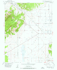 1949 Cedar City NW1949 Print · USGSIron County mining and valley life are captured here at mid-century, just as several major mines reached inactivity. Genealogists and historians can trace the Union Pacific line to the Smith Mine, the settlement of Hamiltons Fort, or the waters of Quichapa Lake.4 unique versions available
 - 1950 Map of Cedar City NW
 1950 Cedar City NW1950 Print · USGSIron County ranching and mining meet in the mid-century Cedar Valley, where the Union Pacific railroad connects small settlements and desert basins. Researchers can trace the layout of Hamiltons Fort, explore the numerous workings of the Great Western Mine, or locate Quichapa Lake.
 - 1950 Map of Kanarraville
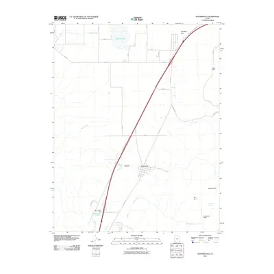
 1950 Kanarraville1950 Print · USGSSouthern Utah ranching and settlement life are captured here at mid-century, where the town of Kanarraville meets the Hurricane Cliffs. Trace old pathways like the Rock Trail or locate family sites near Kanarra Creek and the local Cemetery.5 unique versions available
 - 1950 Map of Cedar City, 1952 Print
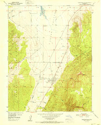
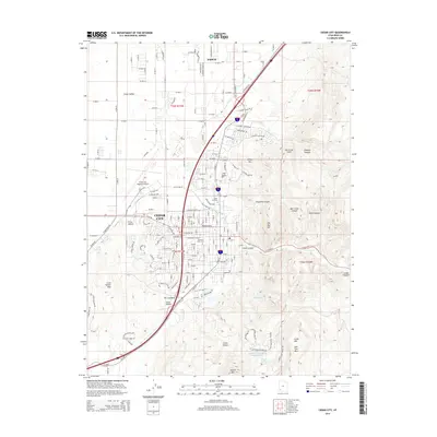
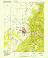 1950 Cedar City1952 Print · USGSCedar City at mid-century is a thriving mountain-valley hub where the railroad and early aviation meet. Genealogists and local historians can trace the town's development through landmarks like the Branch Agricultural College, the Stock Yards, and the local Cemetery.6 unique versions available
 - 1950 Map of Cedar City, 1959 Print
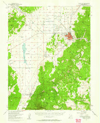 1950 Cedar City1959 Print · USGSIron County entered the 1950s as a thriving hub of mining and education centered on Cedar City. Local historians can trace the rail-to-mine connections of the Union Pacific or locate early landmarks like the College of Southern Utah and Hamiltons Fort.
 - 1950 Map of Cedar Mountain, 1974 Print
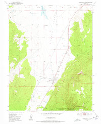
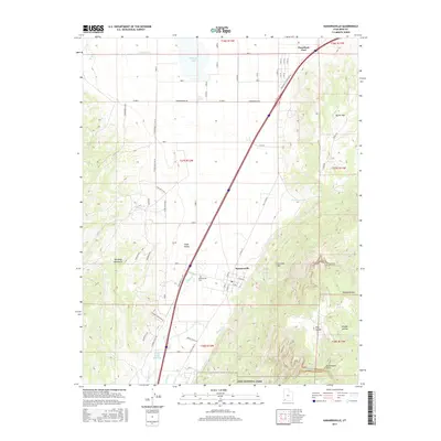
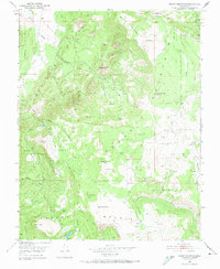 1950 Cedar Mountain1974 Print · USGSSouthern Utah at the mid-century was a landscape of high-altitude industry and water engineering along the Hurricane Cliffs. Trace the region's mining and ranching history through the Tucker Coal Mine, the Meadow Reservoir, and numerous named springs.2 unique versions available
 - 1951 Map of Kanarraville
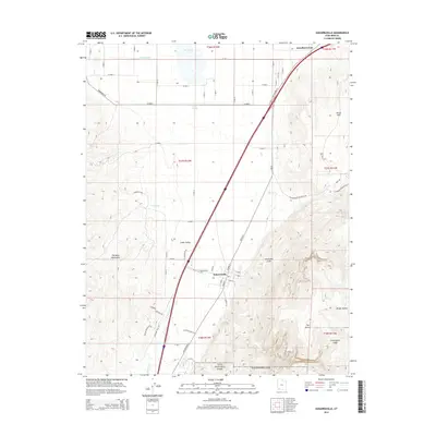
 1951 Kanarraville1951 Print · USGSKanarraville and the Cedar Valley are captured here in the early 1950s, showing the town's original footprint along the Hurricane Cliffs. Genealogists and local historians can locate the Cemetery, trace the path of Kanarra Creek, and identify early water features like Mud Springs.
 - 1952 Map of Cedar Mountain
 1952 Cedar Mountain1952 Print · USGSSouthern Utah's high plateaus and mining frontiers are mapped here at the start of the 1950s. Trace early industrial footprints through the Tucker Coal Mine, follow the old Pipe Line, and locate family-named landmarks like Pryor Knoll and Graff Pt.
 - 1953 Map of Cedar City, 1966 Print
 1953 Cedar City1966 Print · USGSSouthwestern Utah's high plateaus and desert basins are mapped here during the mid-fifties, showing the region before the modern interstate system. Researchers can trace historic mining at Silver Reef, follow the Union Pacific line, and locate early settlements like Kanarraville and Toquerville.3 unique versions available
 - 1958 Map of Cedar City
 1958 Cedar City1958 Print · USGSSouthwestern Utah in the late fifties was a land of mineral extraction and monumental landscapes. Genealogists and historians can trace pioneer-era settlements like Grafton and Parowan alongside industrial sites such as the Silver Reef Mine.2 unique versions available
 - 1962 Map of Cedar City
 1962 Cedar City1962 Print · USGSSouthern Utah in the early sixties showcases a landscape of dramatic plateaus and historic mining outposts. Trace the early settlement patterns at the Silver Reef (ruins), locate the Iron Mine near the Hurricane Cliffs, or find the Fort Harmony Monument.
 - 1982 Map of Cedar City
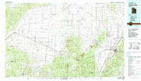 1982 Cedar City1982 Print · USGSThe high desert and mountain ranges of southern Utah are captured here in the early eighties, from the growth of the foothills to remote rail sidings. Genealogists and historians can trace the paths between Cedar City, the desert junctions of Beryl Junction, and local landmarks like Quichapa Lake.
 - 2011 Map of Cedar City, 2011 Print
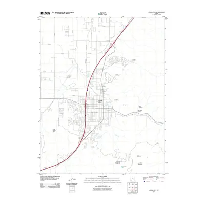 2011 Cedar City2011 Print · USGSCovers Cedar City, including Enoch, Cedar Highlands, and other nearby areas
 - 2011 Map of Cedar City NW, 2011 Print
 2011 Cedar City NW2011 Print · USGSCovers Cedar City, including Iron County, United States, and other nearby areas
 - 2011 Map of Kanarraville, 2011 Print
 2011 Kanarraville2011 Print · USGSCovers Cedar City, including Kanarraville, Iron County, and other nearby areas
 - 2011 Map of Cedar Mountain, 2011 Print
 2011 Cedar Mountain2011 Print · USGSCovers Cedar City, including Cedar Highlands, Iron County, and other nearby areas
 - 2014 Map of Cedar Mountain, 2014 Print
 2014 Cedar Mountain2014 Print · USGSCovers Cedar City, including Cedar Highlands, Iron County, and other nearby areas
 - 2014 Map of Cedar City NW, 2014 Print
 2014 Cedar City NW2014 Print · USGSCovers Cedar City, including Iron County, United States, and other nearby areas
 - 2014 Map of Cedar City, 2014 Print
 2014 Cedar City2014 Print · USGSCovers Cedar City, including Enoch, Cedar Highlands, and other nearby areas
 - 2014 Map of Kanarraville, 2014 Print
 2014 Kanarraville2014 Print · USGSCovers Cedar City, including Kanarraville, Iron County, and other nearby areas
 - 2017 Map of Cedar Mountain, 2017 Print
 2017 Cedar Mountain2017 Print · USGSCovers Cedar City, including Cedar Highlands, Iron County, and other nearby areas
 - 2017 Map of Cedar City NW, 2017 Print
 2017 Cedar City NW2017 Print · USGSCovers Cedar City, including Iron County, United States, and other nearby areas
 - 2017 Map of Kanarraville, 2017 Print
 2017 Kanarraville2017 Print · USGSCovers Cedar City, including Kanarraville, Iron County, and other nearby areas
Showing maps 1-25 of 34
Top cities near Cedar City
- Enoch historical maps
- Parowan historical maps
- Kanarraville historical maps
- New Harmony historical maps
- Summit historical maps
Frequently asked questions
- What are the different types of historical maps available for Cedar City?
- What is the oldest map of Cedar City?
- Where can I purchase historical maps of Cedar City for my home or office?
- Where can I download high-res historical maps of Cedar City?
- Are there historical topographic maps available for Cedar City?
- Is there historical aerial imagery available for Cedar City?
- Where are historical maps of Cedar City sourced from?