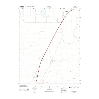
2011 Map of Kanarraville
USGS Topo · Published 2011About this map
Kanarraville and the ranching lands of the northern Mojave desert margin are documented here during the early twenty-first century. The settlement pattern is defined by the historic north-south travel corridor of Old US Hwy 91 and the modern interstate, which bypass the grid-laid heart of the town. To the north, the ephemeral Quichapa Lake and nearby Mud Springs indicate the vital importance of water management in this arid environment, further evidenced by the Harris Gubler Dam and its associated Harris Gubler Reservoir near the southern boundary. To the east, the terrain rises sharply into the North Hills, where landmarks like The Saucer and Woods Hollow break the high-desert landscape. Local history and genealogy are anchored by the Kanarraville Cemetery, while the surrounding network of routes like Kanarra Mtn Rd and Taylor Mtn Rd provide access to the interior canyons and springs.
Find a feature on this map
25 named features on this map. Tap any name to fly to it.
Don’t see what you’re looking for? This feature index may not catch every label — zoom into the map to look around manually.
Map Details
Editions of this 2011 Kanarraville Map
This is the sole edition of this map. No revisions or reprints were ever made.
Other maps of this area

1885 · St. George
USGS Topo · 1:250,000

1891 · St. George
USGS Topo · 1:250,000

1949 · Cedar City NW
USGS Topo · 1:24,000

1950 · Cedar City NW
USGS Topo · 1:24,000

1950 · Kanarraville
USGS Topo · 1:24,000

1950 · Cedar City
USGS Topo · 1:24,000

1950 · Iron Mountain
USGS Topo · 1:62,500

1950 · Cedar City
USGS Topo · 1:62,500

1950 · Cedar Mountain
USGS Topo · 1:24,000

1950 · Stoddard Mtn
USGS Topo · 1:24,000