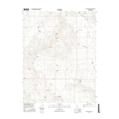
2017 Map of Cedar Mountain
USGS Topo · Published 2017About this map
Hurricane Cliffs dominate the western edge of this Iron County landscape, where the high plateaus of southwest Utah transition into deep drainage basins. High-elevation landmarks like Sugarloaf Mtn and Cedar Mountain overlook a complex network of seasonal watercourses, including Shirts Cr and Murie Cr, which have carved numerous canyons and hollows through the years. The map reveals a history of land use and navigation through labels such as Cabbage Valley, Co-op Flat, and Oak Spring Flat, names that suggest the area's grazing and agricultural past. Movement across this terrain is defined by rugged corridors like Kolob Rd and Kanarra Rd, which connect isolated features such as Graff Point and The Pyramids. These labels, alongside family-named points like Lee Point and Pryor Knoll, offer genealogists and local historians a clear picture of the geographic identifiers used by residents in the 21st century.
Find a feature on this map
58 named features on this map. Tap any name to fly to it.
Don’t see what you’re looking for? This feature index may not catch every label — zoom into the map to look around manually.
Map Details
Editions of this 2017 Cedar Mountain Map
This is the sole edition of this map. No revisions or reprints were ever made.
Other maps of this area

1885 · St. George
USGS Topo · 1:250,000

1886 · Kanab
USGS Topo · 1:250,000

1891 · St. George
USGS Topo · 1:250,000

1949 · Cedar City NW
USGS Topo · 1:24,000

1950 · Cedar City NW
USGS Topo · 1:24,000

1950 · Kanarraville
USGS Topo · 1:24,000

1950 · Cedar City
USGS Topo · 1:24,000

1950 · Cedar City
USGS Topo · 1:62,500

1950 · Cedar Mountain
USGS Topo · 1:24,000

1951 · Kanarraville
USGS Topo · 1:24,000