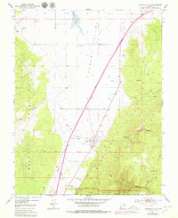
1950 Map of Kanarraville
USGS Topo · Published 1979About this map
Kanarraville sits at the foot of the Hurricane Cliffs, serving as a focal point for settlement where the water of Kanarra Creek reaches the Cedar Valley. The 1950 topography shows a landscape defined by sharp transitions from the Harmony Mountains in the west to the high plateaus of the east, which include a portion of Zion National Park. A lone cemetery and a prospect indicate early local activity and land use on the valley fringe. The presence of ephemeral water features like Quichapa Lake and various spillways, including Spillway 5332, suggests the complex water management required in this arid Iron County environment. To the east, the terrain rises dramatically into the North Hills, where landmarks like The Saucer and Sweetwater Spring break the higher elevations.
Find a feature on this map
28 named features on this map. Tap any name to fly to it.
Don’t see what you’re looking for? This feature index may not catch every label — zoom into the map to look around manually.
Map Details
Editions of this 1950 Kanarraville Map
5 editions found
Other maps of this area

1885 · St. George
USGS Topo · 1:250,000

1891 · St. George
USGS Topo · 1:250,000

1949 · Cedar City NW
USGS Topo · 1:24,000

1950 · Cedar City NW
USGS Topo · 1:24,000

1950 · Kanarraville
USGS Topo · 1:24,000

1950 · Cedar City
USGS Topo · 1:24,000

1950 · Iron Mountain
USGS Topo · 1:62,500

1950 · Cedar City
USGS Topo · 1:62,500

1950 · Cedar Mountain
USGS Topo · 1:24,000

1950 · Stoddard Mtn
USGS Topo · 1:24,000