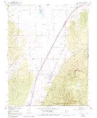
1950 Map of Kanarraville
USGS Topo · Published 1991About this map
Kanarraville sits at the foot of the Hurricane Cliffs, where the open reaches of Cedar Valley meet the rising terrain of the North Hills. This 1950 survey, updated with revisions through the late 1970s, captures the settlement's reliance on local water sources like Kanarra Creek and the nearby Springs. To the west, the Harmony Mountains loom over the basin, while the eastern edge of the map reveals the transition into the northernmost section of Zion National Park. A single Cemetery and a Prospect mine site near the town indicate the local history of settlement and early resource extraction. The landscape is defined by its drainage patterns, with Quichapa Lake and its associated Quichapa Creek appearing in the north, contrasting with the more arid features such as Mud Springs and The Saucer.
Find a feature on this map
27 named features on this map. Tap any name to fly to it.
Don’t see what you’re looking for? This feature index may not catch every label — zoom into the map to look around manually.
Map Details
Editions of this 1950 Kanarraville Map
5 editions found
Other maps of this area

1885 · St. George
USGS Topo · 1:250,000

1891 · St. George
USGS Topo · 1:250,000

1949 · Cedar City NW
USGS Topo · 1:24,000

1950 · Cedar City NW
USGS Topo · 1:24,000

1950 · Kanarraville
USGS Topo · 1:24,000

1950 · Cedar City
USGS Topo · 1:24,000

1950 · Iron Mountain
USGS Topo · 1:62,500

1950 · Cedar City
USGS Topo · 1:62,500

1950 · Cedar Mountain
USGS Topo · 1:24,000

1950 · Stoddard Mtn
USGS Topo · 1:24,000