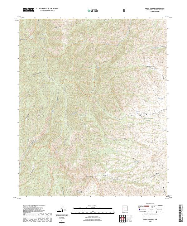
2023 Map of Grassy Lookout
USGS Topo · Published 2023About this map
The San Mateo Mountains dominate this high-altitude terrain in Socorro County, where the Withington Wilderness and Cibola National Forest converge. The landscape is defined by a dense network of drainages including Water Canyon, Deer Spring Canyon, and East Red Canyon. Cultural history is anchored by the Rosedale Cem located near Rosedale Canyon, a site connected to the region's early mining activity. This 2023 survey illustrates the continued reliance on scattered water sources in this arid environment, naming numerous stock tanks and natural seeps such as Cyanide Tank, Big Rosa Tank, and Sanchez Trough Spring. Access through this remote country is provided by several named routes including the Apache Kid Trl and Whitewater Trl, while prominent summits like Tower Peak and Wildcat Peak serve as primary landmarks for navigation.
Find a feature on this map
65 named features on this map. Tap any name to fly to it.
Don’t see what you’re looking for? This feature index may not catch every label — zoom into the map to look around manually.
Map Details
Editions of this 2023 Grassy Lookout Map
This is the sole edition of this map. No revisions or reprints were ever made.
Other maps of this area

1954 · Tularosa
USGS Topo · 1:250,000

1958 · Tularosa
USGS Topo · 1:250,000

1964 · Welty Hill
USGS Topo · 1:24,000

1964 · San Juan Peak
USGS Topo · 1:24,000

1964 · Bay Buck Peaks
USGS Topo · 1:24,000

1964 · Blue Mountain
USGS Topo · 1:24,000
1964 · Grassy Lookout
USGS Topo · 1:24,000

1964 · Monica Saddle
USGS Topo · 1:24,000
1965 · Tenmile Hill
USGS Topo · 1:24,000
1965 · Squaw Peak
USGS Topo · 1:24,000