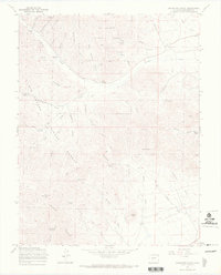
1967 Map of Graveyard Gulch
USGS Topo · Published 1970About this map
Rio Grande National Forest dominates this landscape in the southern Sangre de Cristo Mountains, where the historic mining and ranching geography of Saguache County remains clearly visible. The map centers on the drainages of Kerber Creek and Schecker Gulch, revealing a network of water sources and mineral claims that once supported local industry. High-elevation landmarks such as Saguache Peak and Copper Butte tower over the gulches, while evidence of early extraction is found at the Pershing Mine and the unnamed Mine near Limekiln Gulch.
Find a feature on this map
46 named features on this map. Tap any name to fly to it.
Don’t see what you’re looking for? This feature index may not catch every label — zoom into the map to look around manually.
Map Details
Editions of this 1967 Graveyard Gulch Map
3 editions found
Other maps of this area

1954 · Pueblo
USGS Topo · 1:250,000

1956 · Montrose
USGS Topo · 1:250,000

1957 · Pueblo
USGS Topo · 1:250,000

1958 · Pueblo
USGS Topo · 1:250,000

1959 · Montrose
USGS Topo · 1:250,000

1959 · Bonanza
USGS Topo · 1:62,500

1959 · Howard
USGS Topo · 1:62,500

1960 · Montrose
USGS Topo · 1:250,000

1962 · Pueblo
USGS Topo · 1:250,000

1966 · Pueblo
USGS Topo · 1:250,000