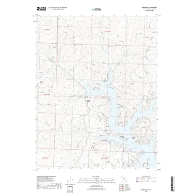
2017 Map of Gravois Mills
USGS Topo · Published 2017About this map
Gravois Mills serves as the focal point for this section of Morgan County, where the hills meet the winding fingers of the Lake of the Ozarks. The topography is defined by the Gravois Arm and its complex network of coves and inlets, including Bogue Bay and Gladstone Cove. This 2017 survey reveals a landscape where modern development and recreational infrastructure, such as Harbour Airport and Sherlock Field, sit alongside deep-rooted family landmarks.
Find a feature on this map
149 named features on this map. Tap any name to fly to it.
Don’t see what you’re looking for? This feature index may not catch every label — zoom into the map to look around manually.
Map Details
Editions of this 2017 Gravois Mills Map
This is the sole edition of this map. No revisions or reprints were ever made.
Other maps of this area

1888 · Versailles
USGS Topo · 1:125,000

1893 · Versailles
USGS Topo · 1:125,000

1904 · Eldon
USGS Topo · 1:62,500

1904 · Gravois Mills
USGS Topo · 1:62,500

1932 · Versailles No 4
USGS Topo · 1:48,000

1934 · Purvis
USGS Topo · 1:24,000

1934 · Irontown Ferry
USGS Topo · 1:24,000

1934 · Lake Ozark
USGS Topo · 1:24,000

1935 · Gravois Mills
USGS Topo · 1:24,000

1935 · Proctor Creek
USGS Topo · 1:24,000