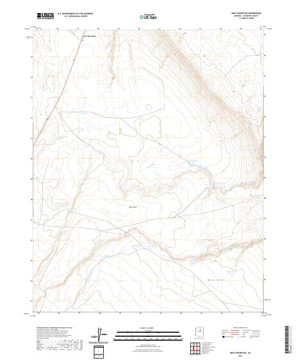
2021 Map of Gray Mountain
USGS Topo · Published 2021About this map
Gray Mountain serves as the primary landmark in this high-altitude landscape within Coconino County, defined by its complex network of seasonal water catchments. The terrain is structured by prominent geological elevations including Black Mesa and White Mesa, which dictate the drainage patterns for Mays Wash and Jackrabbit Wash. This 2021 survey illustrates how local ranchers and land managers have adapted to the arid environment through an extensive system of named stock tanks and dams. Features such as Rimmy Jim Tank, East Rimmy Tank, and Peterson Tank are critical infrastructure points across the township and range divisions. The distribution of these water sources, including the specifically identified Cement Dam Tank and East Spider Tank, reveals the strategic management of this open range before the land descends toward the more deeply carved washes of the southern portion of the quadrangle.
Find a feature on this map
19 named features on this map. Tap any name to fly to it.
Don’t see what you’re looking for? This feature index may not catch every label — zoom into the map to look around manually.
Map Details
Editions of this 2021 Gray Mountain Map
This is the sole edition of this map. No revisions or reprints were ever made.
Other maps of this area

1886 · San Francisco Mtns
USGS Topo · 1:250,000

1891 · San Francisco Mtns
USGS Topo · 1:250,000

1894 · San Francisco Mtns
USGS Topo · 1:250,000

1899 · San Francisco Mtns
USGS Topo · 1:250,000

1947 · Flagstaff
USGS Topo · 1:250,000

1954 · Flagstaff
USGS Topo · 1:250,000

1955 · Black Falls NE
USGS Topo · 1:24,000

1955 · Coconino Pt SE
USGS Topo · 1:24,000

1955 · Cameron SW
USGS Topo · 1:24,000
1955 · Cameron SE
USGS Topo · 1:24,000