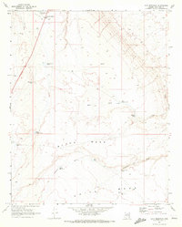
1969 Map of Gray Mountain
USGS Topo · Published 1972About this map
Gray Mountain serves as the focal point of this Coconino County landscape during the late 1960s, situated near a local Landing Strip and a series of managed water resources. The terrain is defined by the high, flat elevations of Black Mesa and White Mesa, separated by the drainage systems of Mays Wash and Jackrabbit Wash. This arid environment required an extensive network of water catchment and storage, evidenced by numerous named features such as Rimmy Jim Tank, Peterson Tank, and Hillside Tank.
Find a feature on this map
22 named features on this map. Tap any name to fly to it.
Don’t see what you’re looking for? This feature index may not catch every label — zoom into the map to look around manually.
Map Details
Editions of this 1969 Gray Mountain Map
This is the sole edition of this map. No revisions or reprints were ever made.
Other maps of this area

1886 · San Francisco Mtns
USGS Topo · 1:250,000

1891 · San Francisco Mtns
USGS Topo · 1:250,000

1894 · San Francisco Mtns
USGS Topo · 1:250,000

1899 · San Francisco Mtns
USGS Topo · 1:250,000

1947 · Flagstaff
USGS Topo · 1:250,000

1954 · Flagstaff
USGS Topo · 1:250,000

1955 · Black Falls NE
USGS Topo · 1:24,000

1955 · Coconino Pt SE
USGS Topo · 1:24,000

1955 · Cameron SW
USGS Topo · 1:24,000
1955 · Cameron SE
USGS Topo · 1:24,000