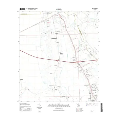
2015 Map of Gray
USGS Topo · Published 2015About this map
Magnolia Plantation, Rebecca Plantation, and Minerva Plantation reflect the deep agricultural heritage of this region on the border of Lafourche Parish and Terrebonne Parish. The landscape is a intricate network of waterways and drainage, defined by the winding paths of Little Bayou Black, Ouiski Bayou, and Bayou Terrebonne. The settlement pattern follows these watercourses and the industrial corridor of the BNSF Railway, with residential clusters such as Schriever, Gray, and Ellendale serving as focal points for local history. Genealogists will find significant value in the documentation of several local burial grounds, including Magnolia Cem, Garden of Memories Cem, and Saint Francis Cem. From the northern reaches near the Thibodaux Municipal Airport to the southern neighborhoods of Broadmoor and Cypress Gardens, this survey provides a contemporary look at the evolving land use in the Louisiana bayou country.
Find a feature on this map
131 named features on this map. Tap any name to fly to it.
Don’t see what you’re looking for? This feature index may not catch every label — zoom into the map to look around manually.
Map Details
Editions of this 2015 Gray Map
This is the sole edition of this map. No revisions or reprints were ever made.
Other maps of this area

1892 · Lac Des Allemands
USGS Topo · 1:62,500

1892 · Gibson
USGS Topo · 1:62,500

1892 · Houma
USGS Topo · 1:62,500

1892 · Thibodaux
USGS Topo · 1:62,500

1897 · Gibson
USGS Topo · 1:62,500

1932 · Lac Des Allemands SW
USGS Topo · 1:31,680

1932 · Houma SW
USGS Topo · 1:31,680

1932 · Houma NW
USGS Topo · 1:31,680

1932 · Thibodaux SE
USGS Topo · 1:31,680

1932 · Thibodaux SW
USGS Topo · 1:31,680