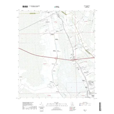
2018 Map of Gray
USGS Topo · Published 2018About this map
Magnolia Plantation and Minerva Plantation anchor a landscape defined by its deep historical roots and the intricate waterways of the southern bayou. Situated along the border of Lafourche and Terrebonne Parishes, the area around Schriever and Gray demonstrates a shift from large-scale agricultural estates to modern residential clusters like Oakshire Manor and Cypress Gardens. The hydrology is particularly complex, with Saint Louis Bayou and Quiski Bayou threading through the low-lying terrain. Genealogy researchers will find several notable burial grounds, including the Garden of Memories Cem and Halfway Cem. Modern infrastructure, such as the Thibodaux Municipal Airport and Fletcher Technical Community College, highlights the regional importance of this corridor as it transitions toward the higher-density developments of the Gulf Coast hinterlands.
Find a feature on this map
126 named features on this map. Tap any name to fly to it.
Don’t see what you’re looking for? This feature index may not catch every label — zoom into the map to look around manually.
Map Details
Editions of this 2018 Gray Map
This is the sole edition of this map. No revisions or reprints were ever made.
Other maps of this area

1892 · Lac Des Allemands
USGS Topo · 1:62,500

1892 · Gibson
USGS Topo · 1:62,500

1892 · Houma
USGS Topo · 1:62,500

1892 · Thibodaux
USGS Topo · 1:62,500

1897 · Gibson
USGS Topo · 1:62,500

1932 · Lac Des Allemands SW
USGS Topo · 1:31,680

1932 · Houma SW
USGS Topo · 1:31,680

1932 · Houma NW
USGS Topo · 1:31,680

1932 · Thibodaux SE
USGS Topo · 1:31,680

1932 · Thibodaux SW
USGS Topo · 1:31,680