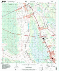
1998 Map of Gray
USGS Topo · Published 2000About this map
The low-lying wetlands of southern Louisiana are defined here by a dense network of waterways and historic sugar-producing landscapes along the Lafourche and Terrebonne Parish boundary. The region's plantation history is evident in the layout of large estates such as Magnolia Plantation, Rebecca Plantation, and Minerva Plantation, which sit alongside established communities like Schriever and Gray. The geography is intricately carved by bayous and canals, including Devil Swamp in the north and the winding Chacahoula Bayou to the southwest. This landscape transitioned from agrarian roots to modern infrastructure by the late 20th century, as seen in the emergence of residential developments like Lazy Acres and Broadmoor. Institutional anchors such as St Bridget Ch, St Francis Cem, and the Evergreen Jr High School serve as vital markers for genealogists tracing family roots in the Terrebonne basin near Bayou Cane.
Find a feature on this map
56 named features on this map. Tap any name to fly to it.
Don’t see what you’re looking for? This feature index may not catch every label — zoom into the map to look around manually.
Map Details
Editions of this 1998 Gray Map
This is the sole edition of this map. No revisions or reprints were ever made.
Other maps of this area

1892 · Lac Des Allemands
USGS Topo · 1:62,500

1892 · Gibson
USGS Topo · 1:62,500

1892 · Houma
USGS Topo · 1:62,500

1892 · Thibodaux
USGS Topo · 1:62,500

1897 · Gibson
USGS Topo · 1:62,500

1932 · Lac Des Allemands SW
USGS Topo · 1:31,680

1932 · Houma SW
USGS Topo · 1:31,680

1932 · Houma NW
USGS Topo · 1:31,680

1932 · Thibodaux SE
USGS Topo · 1:31,680

1932 · Thibodaux SW
USGS Topo · 1:31,680