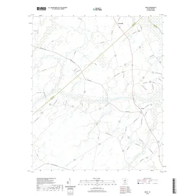
2020 Map of Grays
USGS Topo · Published 2020About this map
Grays and Horsegall anchor this rural landscape in the Lowcountry of South Carolina, where the boundary between Hampton and Jasper counties follows old property and drainage lines. The terrain is defined by a dense network of blackwater streams and branches, including Alligator Cr and the winding Cypress Cr, which flow through the marshy interior. Evidence of the region's timber history is preserved in names like Old Tram Rd, while a complex web of local routes—such as Browning Gate Rd, Smith Rd, and Langfordville Rd—connects scattered homesteads and family-named landmarks like Stella Cleland Rd. The map illustrates the persistent agricultural and forestry character of the area, with numerous small crossings over Horsegall Cr and Elbo Cr marking the transition between cultivated land and the wooded wetlands of Cane Gall.
Find a feature on this map
56 named features on this map. Tap any name to fly to it.
Don’t see what you’re looking for? This feature index may not catch every label — zoom into the map to look around manually.
Map Details
Editions of this 2020 Grays Map
This is the sole edition of this map. No revisions or reprints were ever made.
Other maps of this area

1918 · Varnville
USGS Topo · 1:62,500

1918 · Yemassee
USGS Topo · 1:62,500

1919 · Pineland
USGS Topo · 1:62,500

1919 · Cummings
USGS Topo · 1:62,500

1943 · Pineland
USGS Topo · 1:62,500

1943 · Yemassee
USGS Topo · 1:62,500

1943 · Cummings
USGS Topo · 1:62,500

1944 · Varnville
USGS Topo · 1:62,500

1947 · Savannah
USGS Topo · 1:250,000

1948 · Savannah
USGS Topo · 1:250,000