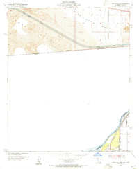
1953 Map of Grays Well NE
USGS Topo · Published 1955About this map
The All American Canal dominates the northern landscape of this survey, cutting a straight industrial path through the drifting Sand Hills of Imperial County. This vital water artery represents the massive engineering efforts of the mid-20th century to reclaim the desert, running parallel to the United States Mexico border. To the east, the terrain shifts into the flat expanse of Pilot Knob Mesa, showing a stark contrast between the active dune fields and the stable desert pavement.
Find a feature on this map
14 named features on this map. Tap any name to fly to it.
Don’t see what you’re looking for? This feature index may not catch every label — zoom into the map to look around manually.
Map Details
Editions of this 1953 Grays Well NE Map
This is the sole edition of this map. No revisions or reprints were ever made.
Other maps of this area

1903 · Yuma
USGS Topo · 1:125,000

1905 · Yuma
USGS Topo · 1:125,000

1940 · Yuma
USGS Topo · 1:62,500

1942 · Yuma
USGS Topo · 1:250,000

1945 · Picacho Peak
USGS Topo · 1:62,500

1945 · Yuma
USGS Topo · 1:62,500

1951 · Picacho Peak
USGS Topo · 1:62,500

1952 · Araz
USGS Topo · 1:24,000

1952 · Yuma West
USGS Topo · 1:24,000

1953 · Grays Well
USGS Topo · 1:24,000