
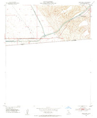
1953 Map of Grays Well
USGS Topo · Published 1954About this map
The borderlands of Imperial County are defined here by the meeting of the East Mesa and the shifting Sand Hills, just north of the international boundary between the United States and Mexico. This mid-century landscape is dominated by the massive water infrastructure of the All American Canal and the Coachella Canal, which cut through the desert to bring water to California's inland valleys. The map documents the localized human activity centered around these works, such as Drop 1 and the nearby Oil Tanks. Historically significant points for travelers and maintenance crews, like Gordons Well and Grays Well, sit alongside the Sand Hills Highway Maintenance Station, marking a period of intense hydraulic engineering and desert transit before the region was further modernized.
Find a feature on this map
13 named features on this map. Tap any name to fly to it.
Don’t see what you’re looking for? This feature index may not catch every label — zoom into the map to look around manually.
Map Details
Editions of this 1953 Grays Well Map
2 editions found
Other maps of this area

1903 · Yuma
USGS Topo · 1:125,000

1905 · Yuma
USGS Topo · 1:125,000

1907 · Holtville
USGS Topo · 1:125,000

1942 · El Centro
USGS Topo · 1:250,000

1942 · Yuma
USGS Topo · 1:250,000

1953 · Ogilby
USGS Topo · 1:62,500

1953 · Cactus
USGS Topo · 1:24,000
1953 · Grays Well NE
USGS Topo · 1:24,000

1954 · El Centro
USGS Topo · 1:250,000
1954 · Glamis SE
USGS Topo · 1:24,000