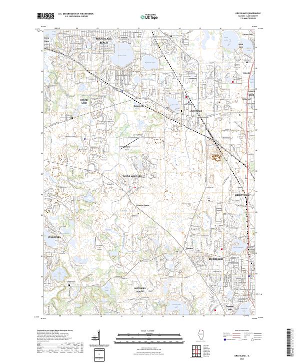
2024 Map of Grayslake
USGS Topo · Published 2024About this map
The northern Illinois lake country around Grayslake and Round Lake is defined by a dense concentration of glacial basins and modern suburban growth. This map reveals a complex landscape where residential developments like Round Lake Beach and Round Lake Park interface with numerous water bodies, including the central Grays Lake and the larger Third Lake to the northeast. The presence of institutional landmarks such as the College of Lake County and the University of Saint Mary of the lake speaks to the region's role as a regional hub for education and community services.
Find a feature on this map
76 named features on this map. Tap any name to fly to it.
Don’t see what you’re looking for? This feature index may not catch every label — zoom into the map to look around manually.
Map Details
Editions of this 2024 Grayslake Map
This is the sole edition of this map. No revisions or reprints were ever made.
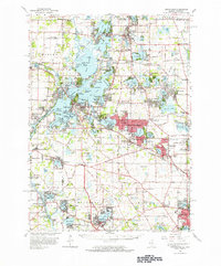
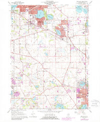
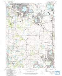
Historical Maps of Third Lake Through Time
4 maps found