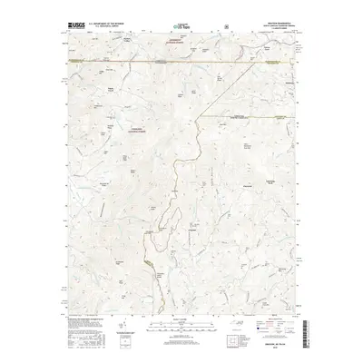
2016 Map of Grayson
USGS Topo · Published 2016About this map
The Tennessee Valley Divide snakes through this high-elevation corner of the Southern Appalachians, where the state lines of Virginia, North Carolina, and Tennessee converge. Settlements like Taylors Valley and Grayson sit within a landscape defined by the Jefferson National Forest and Cherokee National Forest. The map detail reveals a deep-rooted rural community through its network of family burial grounds and small mountain schools, including the Burnt School Cem and Rye Cove Cem.
Find a feature on this map
130 named features on this map. Tap any name to fly to it.
Don’t see what you’re looking for? This feature index may not catch every label — zoom into the map to look around manually.
Map Details
Editions of this 2016 Grayson Map
This is the sole edition of this map. No revisions or reprints were ever made.
Other maps of this area

1891 · Abingdon
USGS Topo · 1:125,000

1893 · Cranberry
USGS Topo · 1:125,000

1894 · Abingdon
USGS Topo · 1:125,000

1895 · Cranberry
USGS Topo · 1:125,000

1899 · Cranberry
USGS Topo · 1:125,000

1902 · Cranberry
USGS Topo · 1:125,000

1909 · Abingdon
USGS Topo · 1:96,000

1911 · Abingdon
USGS Topo · 1:125,000

1935 · Konnarock
USGS Topo · 1:24,000

1935 · Grayson
USGS Topo · 1:24,000