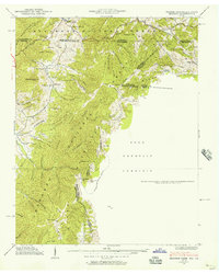
1938 Map of Grayson
USGS Topo · Published 1957About this map
Taylors Valley and the surrounding high country sit at the convergence of three states in the late 1930s, where the Jefferson National Forest meets the Cherokee National Forest. This survey captures the rural infrastructure of the era, from the State Line Sch near Matney to several country churches including Waldener Grove Ch and Bethel Ch. The Norfolk and Western railroad winds through the northern terrain, serving remote settlements like Green Cove and Whitetop. Much of the landscape is defined by steep ridges and named hollows, such as Negro Shanty Hollow and Bill Gentry Hollow, reflecting long-established local names. Significant landform features like Pond Mountain and Fooderstack Mtn dominate the topography, while the Sutherland Cem near Sang Cave Branch provides a specific point of interest for genealogists tracing families in this mountainous border region.
Find a feature on this map
74 named features on this map. Tap any name to fly to it.
Don’t see what you’re looking for? This feature index may not catch every label — zoom into the map to look around manually.
Map Details
Editions of this 1938 Grayson Map
This is the sole edition of this map. No revisions or reprints were ever made.
Other maps of this area

1891 · Abingdon
USGS Topo · 1:125,000

1893 · Cranberry
USGS Topo · 1:125,000

1894 · Abingdon
USGS Topo · 1:125,000

1895 · Cranberry
USGS Topo · 1:125,000

1899 · Cranberry
USGS Topo · 1:125,000

1902 · Cranberry
USGS Topo · 1:125,000

1909 · Abingdon
USGS Topo · 1:96,000

1911 · Abingdon
USGS Topo · 1:125,000

1935 · Konnarock
USGS Topo · 1:24,000

1935 · Grayson
USGS Topo · 1:24,000