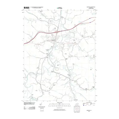
2010 Map of Grayson
USGS Topo · Published 2010About this map
Grayson serves as the central hub of this eastern Kentucky landscape, where the Little Sandy River and its numerous tributaries like Town Branch and Wolf Creek carve through a network of hollows and ridges. The map reveals a high density of family and community burial sites, including Seaton Cemetery, Goebel Cemetery, and the Carter County Memorial Gardens, offering significant value for genealogical research in Carter County.
Find a feature on this map
105 named features on this map. Tap any name to fly to it.
Don’t see what you’re looking for? This feature index may not catch every label — zoom into the map to look around manually.
Map Details
Editions of this 2010 Grayson Map
This is the sole edition of this map. No revisions or reprints were ever made.
Other maps of this area

1903 · Kenova
USGS Topo · 1:125,000

1904 · Kenova
USGS Topo · 1:125,000

1950 · Bruin
USGS Topo · 1:24,000

1950 · Grahn
USGS Topo · 1:24,000

1950 · Tygarts Valley
USGS Topo · 1:24,000

1953 · Grayson
USGS Topo · 1:24,000

1953 · Oldtown
USGS Topo · 1:24,000

1953 · Rush
USGS Topo · 1:24,000
1953 · Argillite
USGS Topo · 1:24,000
1953 · Webbville
USGS Topo · 1:24,000