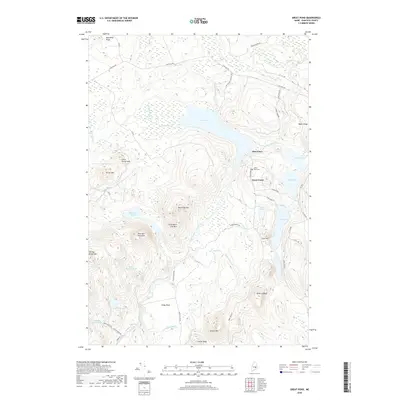
2018 Map of Great Pond
USGS Topo · Published 2018About this map
Great Pond and the surrounding Hancock County wilderness are defined by an intricate network of glacial lakes and mountain peaks. The West Branch Union River flows through a landscape marked by high elevations like Black Cap Mtn and Turner Mtn, while the Silsby Plain offers a rare stretch of level terrain to the south. Small settlements like Dow Pines and the village of Great Pond itself represent the primary human footprints in this heavily forested region, with the Great Pond Cem serving as a significant point of interest for genealogists tracing local families.
Find a feature on this map
53 named features on this map. Tap any name to fly to it.
Don’t see what you’re looking for? This feature index may not catch every label — zoom into the map to look around manually.
Map Details
Editions of this 2018 Great Pond Map
This is the sole edition of this map. No revisions or reprints were ever made.
Other maps of this area

1929 · Great Pond
USGS Topo · 1:48,000

1929 · Lead Mountain
USGS Topo · 1:48,000

1931 · Saponac
USGS Topo · 1:48,000

1932 · Nicatous Lake
USGS Topo · 1:48,000

1932 · Lead Mountain
USGS Topo · 1:62,500

1932 · Great Pond
USGS Topo · 1:62,500

1934 · Saponac
USGS Topo · 1:62,500

1934 · Nicatous Lake
USGS Topo · 1:62,500

1948 · Bangor
USGS Topo · 1:250,000

1954 · Millinocket
USGS Topo · 1:250,000