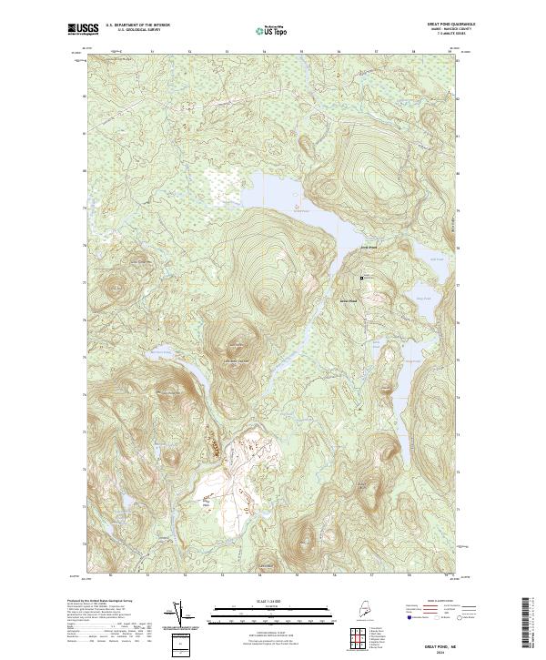
2024 Map of Great Pond
USGS Topo · Published 2024About this map
Great Pond and its surrounding wetlands form the center of this Hancock County landscape, where the West Branch Union River flows south through a series of prominent peaks and basins. The terrain is defined by dramatic elevations such as Morrison Pond Mtn and Little Black Cap Mtn, interspersed with smaller water bodies like Rift Pond and Little Pond. Human activity is concentrated near the settlement of Great Pond and the Dow Pines area, with the Great Pond Cem providing a fixed point for local history and genealogical research.
Find a feature on this map
46 named features on this map. Tap any name to fly to it.
Don’t see what you’re looking for? This feature index may not catch every label — zoom into the map to look around manually.
Map Details
Editions of this 2024 Great Pond Map
This is the sole edition of this map. No revisions or reprints were ever made.
Other maps of this area

1929 · Great Pond
USGS Topo · 1:48,000

1929 · Lead Mountain
USGS Topo · 1:48,000

1931 · Saponac
USGS Topo · 1:48,000

1932 · Nicatous Lake
USGS Topo · 1:48,000

1932 · Lead Mountain
USGS Topo · 1:62,500

1932 · Great Pond
USGS Topo · 1:62,500

1934 · Saponac
USGS Topo · 1:62,500

1934 · Nicatous Lake
USGS Topo · 1:62,500

1948 · Bangor
USGS Topo · 1:250,000

1954 · Millinocket
USGS Topo · 1:250,000